Precise stays private
Exact coordinates support enrichment and QA inside protected infrastructure only.
Open science for the ground beneath us
We’re building a shared reference library that connects smartphone soil observations and sample metadata with instrument spectra and laboratory evidence from the same physical samples. Open AI models and better soil maps are the goal.
In development. Public capture and library uploads remain closed.
The evidence we’re building toward
No printed card is needed. Capture context and a fresh-face close-up where you have permission to sample.
Learn moreRecord the place and surface condition. Library sample registration is optional and requires your real declared depth. Public capture is closed.
Learn moreLink instrument spectra and laboratory evidence to that same sample, with method and calibration records.
Learn moreVerify rights, pairing and quality before independent model evaluation or an eligible public release.
Learn moreOpen soil context
The map is one way to use the library’s future evidence. Today it offers SoilGrids SOC, pH, and clay context, with a layer for eligible community coverage in H3 cells. These priors are estimates, not new measurements; deeper zoom never invents finer source resolution.
Open the global map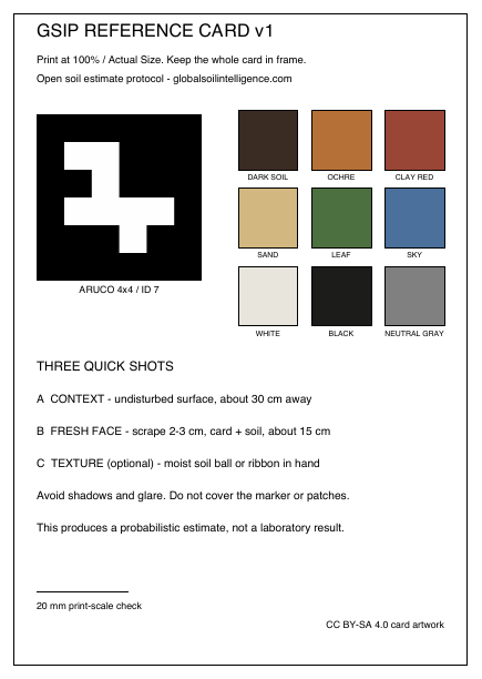
A shared visual aid
If you have the free physical reference card, include it for geometry and image checks. No printed card is needed. A card does not turn a phone into a spectrometer; phone photographs and any separately extracted soil RGB remain uncalibrated.
From shared evidence to open models
Code and local tools are available now. Public releases wait for rights, privacy, scientific and operator gates.
Privacy by architecture
Exact coordinates support enrichment and QA inside protected infrastructure only.
The pipeline sanitizes embedded metadata. Photo publication stays held until screening is deployed and its calibration approved.
Public soil maps are priors, not truth. Future estimates must show their basis and confidence.
Built in the open
The apps, backend, data pipeline, library tools, modelling code, API and reference-card generator are available in the public repository. Fork, run, modify and extend the MIT-licensed software, or build on one part of it.
Run a private local library node with the public source. Your records and credentials remain protected. These tools do not register a node for GSIP’s hosted service; public uploads stay closed. We welcome developers, soil scientists and spectroscopy labs to help build verified paired evidence and future open models.